Product · September 15, 2025
A revamped CYVL platform: smarter, more flexible, built for municipalities
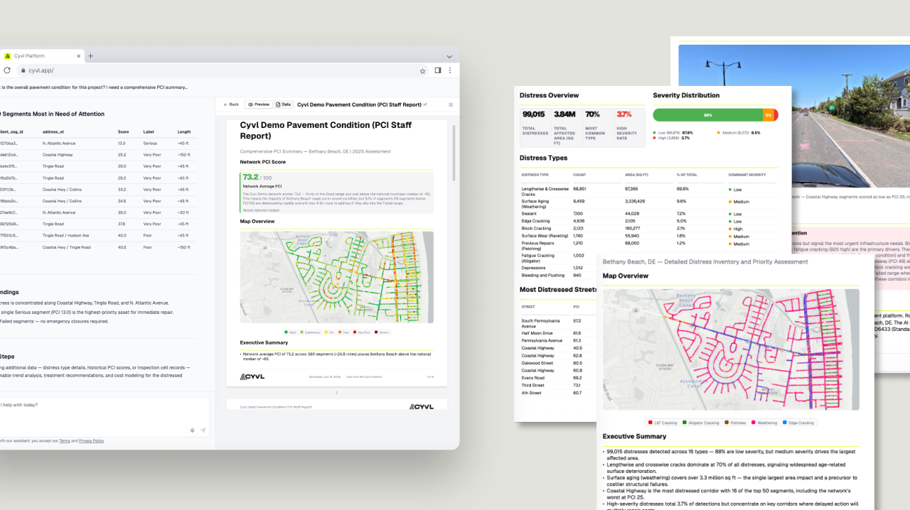
A space where municipal teams can combine their own local data with CYVL's high-quality sensor data to unlock deeper, more actionable insights.

At CYVL, our mission has always been to help municipalities make better, faster, and more data-driven infrastructure decisions. With our latest platform update, we're creating a space where municipal teams can combine their own local data with CYVL's high-quality sensor data to unlock deeper, more actionable insights.
Upload your own data
Every municipality has unique internal datasets — parcel information, income levels, ZIP code boundaries — that provide valuable context. You can now upload those internal layers directly into the platform. No need to export, reformat, or switch between systems; everything lives in one place.
Ask better questions with the Infrastructure Intelligence Platform
An AI-powered tool helps you uncover relationships between datasets — whether the data comes from CYVL or your own uploads. Ask how pavement conditions vary across income levels, or which neighborhoods show the highest overlap between road age and repair requests. The answers display visually on the map, so patterns are clear and immediately actionable.