Sidewalks & ADA
Build a defensible ADA transition plan from real sidewalk data.
CYVL inventories and assesses every sidewalk and curb ramp in your right-of-way, giving you a compliance baseline you can plan against and stand behind.
The problem
ADA exposure you can't see is exposure you can't defend.
Most agencies don't have a complete picture of their sidewalks and curb ramps — which means no real baseline for ADA compliance and growing legal exposure.
Building that inventory the old way means crews walking the network for months or years. So it doesn't get done, and the risk keeps sitting there.
What you get
Understand what you have. Then act on it.
Understand — the data
- Every sidewalk and curb ramp located across the right-of-way
- Measured attributes and precise dimensions — width, slope, condition
- Assessed against ADA criteria so you know what actually needs work
Act — the decisions
- A defensible ADA transition plan backed by real data
- Prioritized fixes that reduce legal exposure first
- A compliance baseline you can show residents, council, and counsel
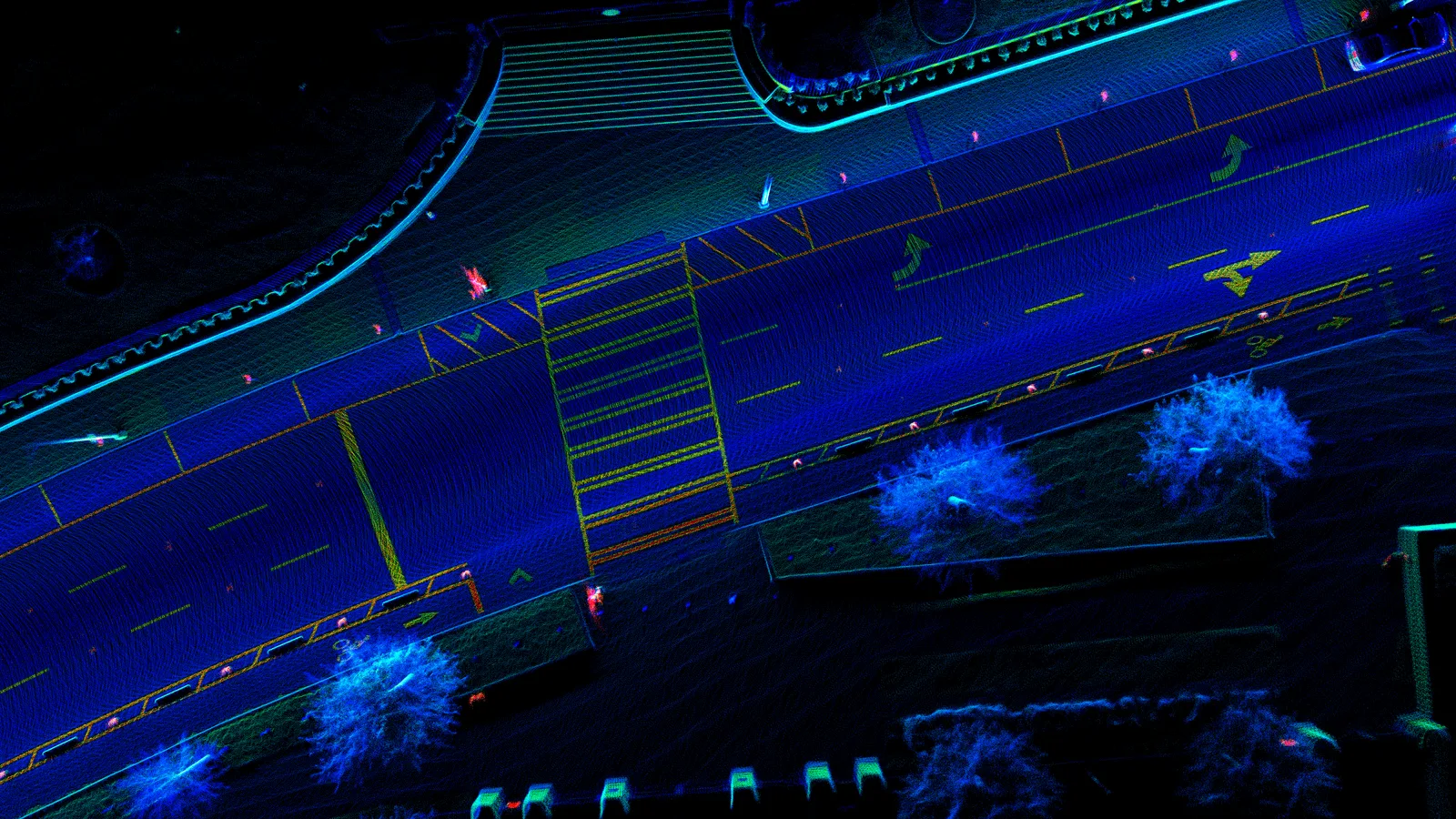
3D Measurement Tools
Measure sidewalks, ramps, and grades — from your desk.
Measure distance, height, grade, and curb reveal straight from a 3D scan of your streets, so you can screen ADA, drainage, and multimodal projects without sending a crew with a tape measure.
Measuring sidewalks, curb ramps, grades, and clearances for ADA or drainage work means sending a crew out with a tape measure — slow, costly, and impossible at network scale.
- Distance & height — sidewalk and road width, curb-ramp height, sign height, overhead clearance, to the centimeter.
- Curb reveal — graph reveal height along any segment, with low spots flagged.
- Elevation zones — draw an area for a color-coded topology map: grade changes, drainage paths, the low spots that flood.
- Screen, then dispatch — screen the whole network for ADA or drainage and send crews only where it actually matters.
Under the hoodRenders CYVL's 3D point cloud in the browser; centimeter-level measurement.
Proof
“If we have data to back up our decision, that's something residents can't argue against.”
100%
Of sidewalks captured in the same pass
1 run
Builds the full ADA baseline
500+
Municipalities served
Trusted by 500+ municipalities.
Why CYVL
The most complete picture, at the lowest lift.
One pass captures everything
A single drive captures every asset in the right-of-way at once — pavement, sidewalks, signs, and more — so you're never paying for separate surveys.
Built for how government buys
Available on cooperative purchasing contracts, with data your team owns. Procurement is straightforward and the path to value is short.
Fastest to value
Most agencies go from first drive to decisions in weeks, not the months a manual survey takes — and the picture stays current after that.