Product · January 31, 2026
Our Public Works Assistant just got smarter
We kicked off 2026 with hyperlocal AI insights, distress-severity filtering, and a rebuilt mobile experience — value whether you're at your desk or in the field.

We kicked off 2026 with a suite of new additions to our Infrastructure Intelligence Platform. From hyperlocal AI insights to mobile-first field tools, this month's updates deliver immediate value whether you're at your desk or in the field.
Draw your way to hyperlocal intelligence
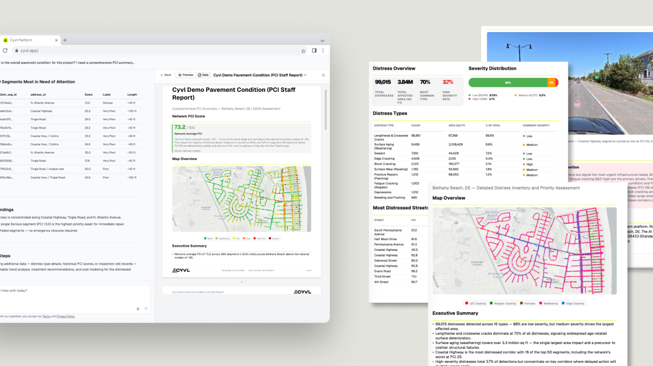
Meet the Crayon tool: instead of analyzing your entire road system, simply draw the exact neighborhood, project zone, or district you care about, then ask your questions. Preparing a RAISE grant for a specific neighborhood, scoping a resurfacing project near the waterfront, or analyzing downtown intersection safety — draw those boundaries and get instant statistics, condition reports, and AI-powered insights for just that area.
See your problems at a glance with severity filtering
New severity sublayers break down every distress type by High, Medium, and Low — with visual opacity that makes priority areas instantly obvious. Filter to high-severity issues when presenting to council for emergency funding, or create prioritized work orders based on actual risk.
Take your intelligence to the field
We rebuilt the Shared Maps mobile experience with native touch gestures — pinch to zoom, tap to inspect, thumb-friendly controls. Your complete road condition data and asset inventory, right in your back pocket, so field crews can access condition data directly from the truck.