Technology · November 14, 2024
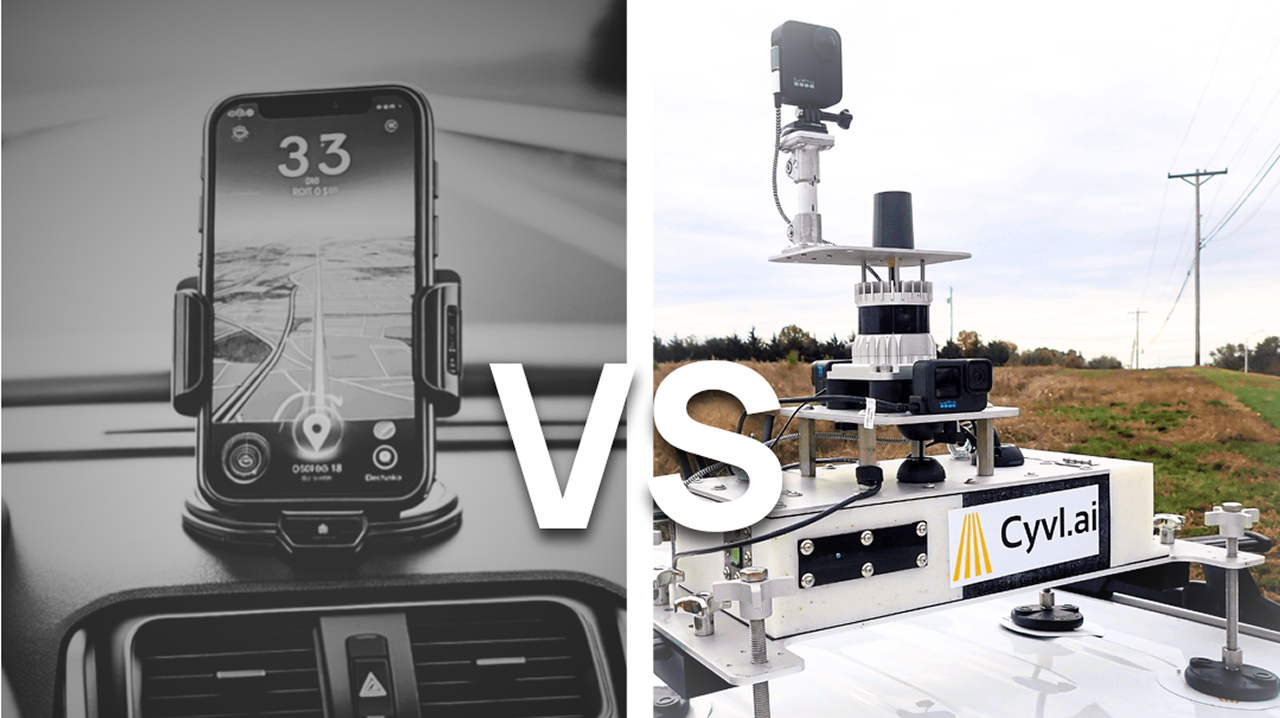
The precision gap: CYVL's RTK vs. smartphone GPS
Standard smartphone GPS hovers around 16 feet of accuracy. CYVL's sensor stack — LiDAR, high-resolution imagery, and RTK — refines that to roughly 3 feet.
The limitations of smartphone-only data collection
Smartphones are everywhere, and their convenience is undeniable. But when it comes to managing critical infrastructure, their limitations become apparent. Standard smartphone GPS accuracy hovers around 16 feet — fine for finding a building, but not precise enough for pinpointing the geolocation of infrastructure assets.
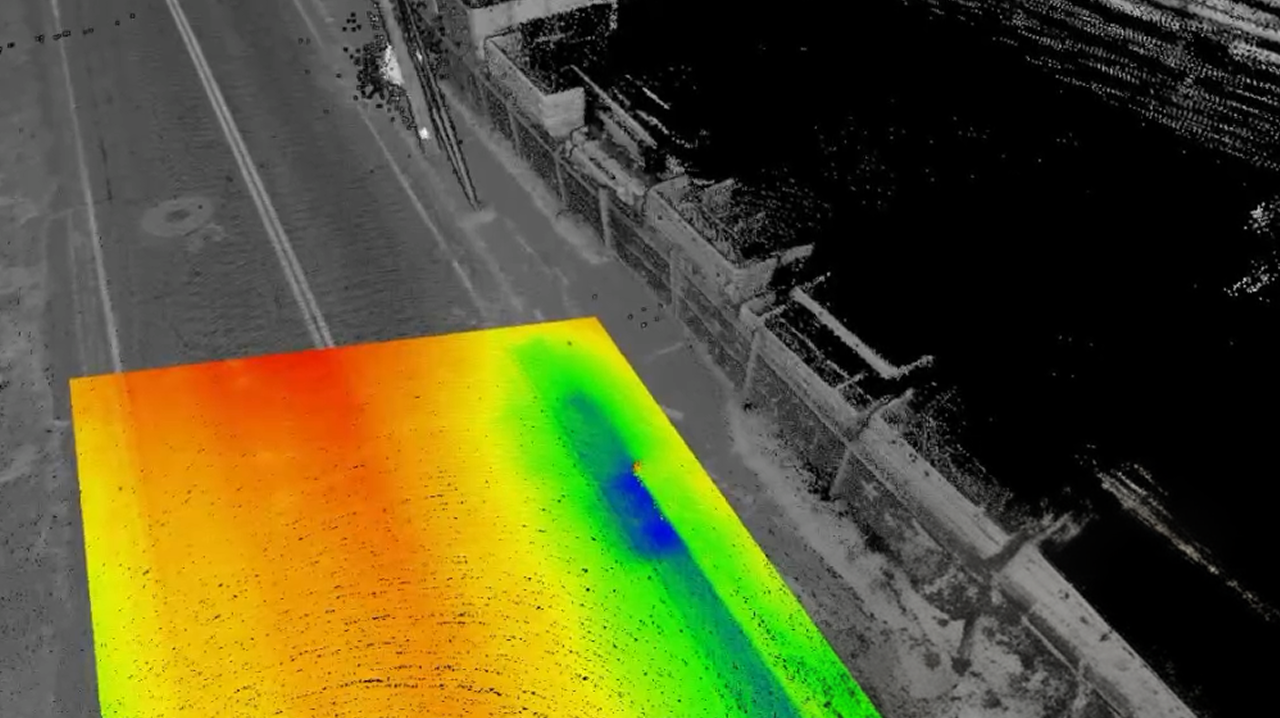
CYVL's advanced sensor stack
We integrate LiDAR, high-resolution imagery, and high-quality RTK for unmatched data accuracy. RTK (Real-Time Kinematic) enhances GPS data, refining accuracy to an impressive 3 feet. From detailed road condition analysis to precise tree inventories, that 3-foot accuracy makes a real difference.
Our approach doesn't stop at precision — combining LiDAR and high-quality imagery provides a richer, more detailed view of assets, leading to smarter, safer, and more cost-effective infrastructure management. It's not just about collecting data; it's about collecting the best data.