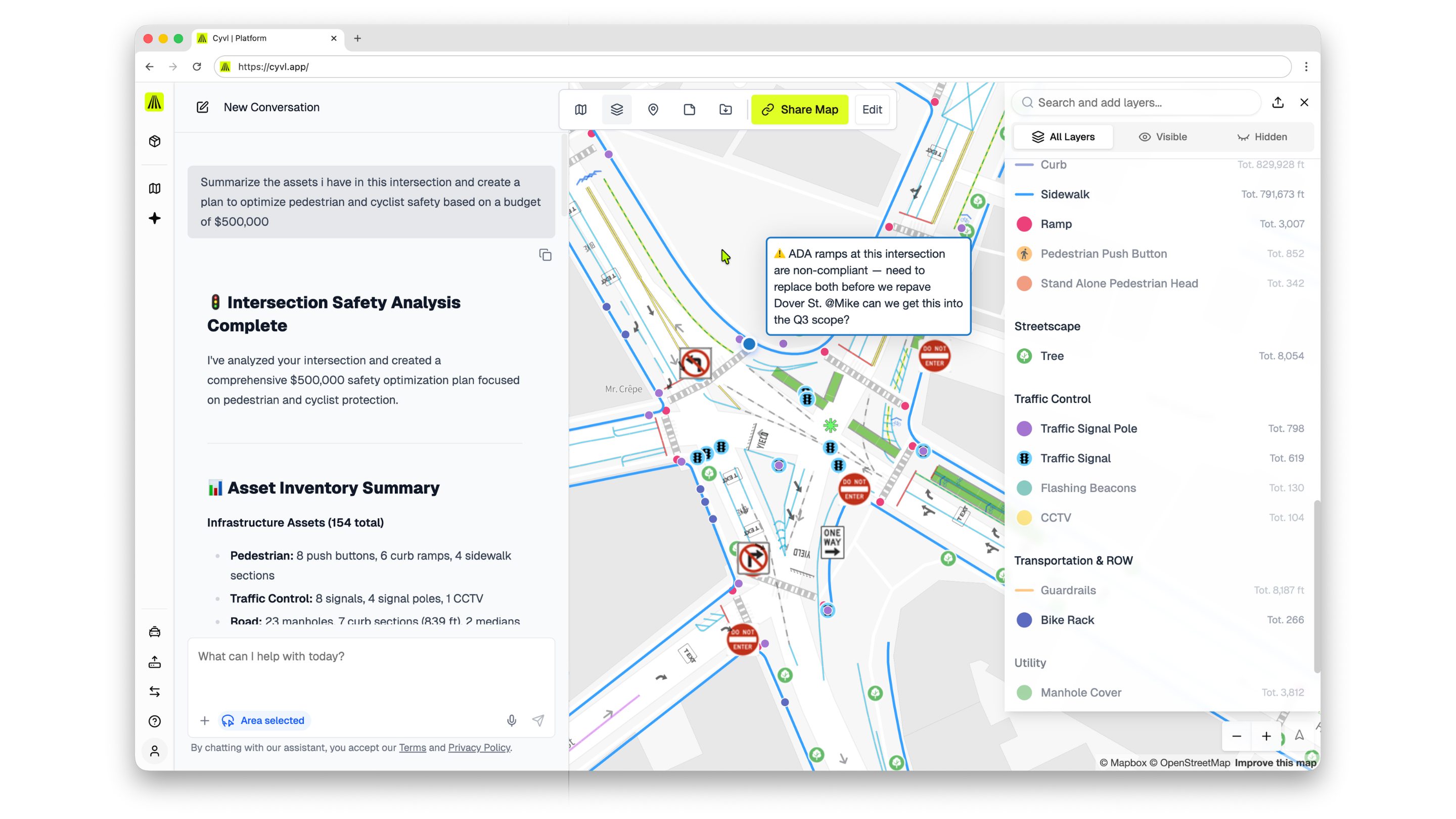
The Infrastructure Intelligence Platform for Cities, Counties, and State DOTs
Cyvl maps every road, sidewalk, sign, and asset in your network — then gives your team the AI-powered digital twin, budgeting tools, and reports to make every infrastructure dollar count.


managed by Cyvl
manual methods
through better decisions

Trusted by 400+ communities and growing — from 30-mile towns to 10,000+ mile roadway networks. Cyvl replaces manual inspections, disconnected spreadsheets, and one-time consultant studies with a continuous infrastructure intelligence system.
• Pavement management (ASTM aligned)
• Sidewalk & ADA transition planning
• Sign, signal, and marking inventories
• AI-powered budgeting and capital planning
• Reporting for councils, grants, and public comms
• Full integrations (Esri/ArcGIS, Cartegraph, Civil 3D)
How It Works
Rapid Mapping
Mount Cyvl's plug-and-play sensors on any vehicle. As your fleet drives, we capture high-resolution LiDAR, 360° imagery, and GPS data across your entire network — roads, sidewalks, signs, signals, markings, trees, catch basins, and more.
Build Your Digital Twin
Cyvl's AI processes your raw data into a living, AI-enabled digital twin of your infrastructure. Every asset is inventoried, scored, and mapped — pavement conditions, ADA compliance gaps, sign retroreflectivity, and distresses down to the block level.
Plan, Budget, and Act
Use Cyvl's web platform to build multi-year capital plans, generate defensible budget requests, create council-ready reports, track construction progress, and detect changes over time. One platform from data collection to decision.
Built for the people who keep communities running
Mayors, public works leaders, and engineers across America are rethinking how infrastructure gets built and maintained. Partner with Cyvl to bring Infrastructure Intelligence to your community.
Take a Look at Cyvl's Success Stories
See how cities and towns are accelerating infrastructure upgrades with high-fidelity data and AI-driven planning.


-%20logo%20(unpadded).png.png)